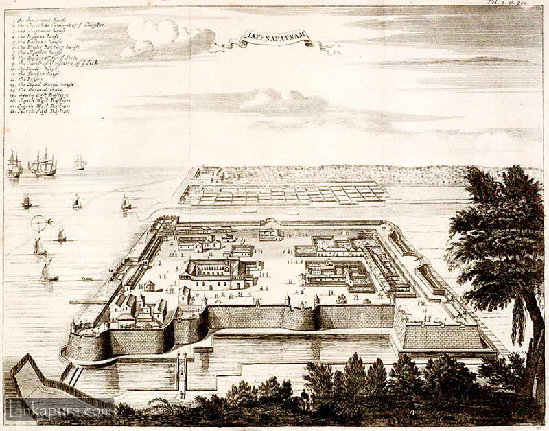
Antique Map of Dutch Fort of Jaffna Patnam, Sri Lanka
Entitled Jaffnapatnam Vol. 3 p. 712 published in ‘A True and Exact Description of the Most Celebrated East-India Coasts of Malabar and Coromandel, and also of the Isle of Ceylon”, it depicts a hill top perspective the fort on the coast of Sri Lanka. This Portuguese built fort was captured by the Dutch and remained under the VOCs command as part of six different coastal territories, after they took over the Portuguese rule as consequence of an over three month siege in 1658. The kingdom of Jaffnapatnam consisted of 13 islands and four provinces, and the Dutch maintained rule for 138 years.
This doesn’t looks like Jaffna fort!
Could you please explain why this antique map looks totally different from the current aerial view of the Jaffna fort?