Antique Map of Dutch Fort of Jaffna Patnam, Sri Lanka Entitled Jaffnapatnam Vol. 3 p. 712 published in ‘A True and Exact Description of the Most Celebrated East-India Coasts of Malabar and Coromandel, and also of the Isle of Ceylon”, it depicts a hill top perspective the fort on the coast of Sri Lanka. This […]

I just wanted to tell you that this is definitely the most enchanting Sri lankan (or Sri lanka related) website that I’ve ever come across! You are doing are wonderful job giving today’s generation glimpses through-out the rich pages of the past. I hope your work continues to be a source of pride & inspiration for the people of Sri lanka & history lovers world-wide. Good luck in your endeavors.
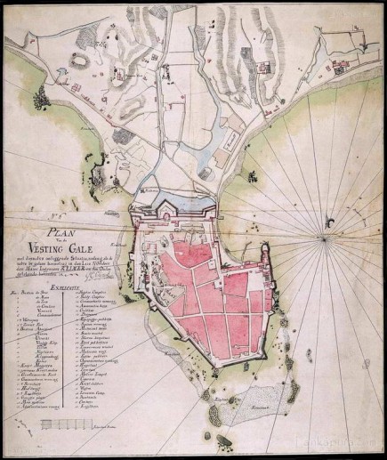
fascinating map. Going from right to left. The two ridges and the two houses inbetween the ridges one on the left is atapattu walawwa still existing, one on the right is pokunu walawwa not in existance.Just below the left ridge is a stream that drains into a sort of lake. This is wakwella rd and the chinese garden well seen in the photograph of china gardens in 1852. In fact even today heavy rain causes flooding of this area. looking to the right from china garden behind the ridges ( on a ridge ) was the ancient chinese inscription brought by Admiral Zhang He The tri lingual inscription of galle. Inbetween the ridges was a river gone dry because of the tapping of the river by the dutch canal system . The ravines are still visible.