Old map of Pollonaruwa – Sri Lanka Old map of Pollonaruwa - Sri Lanka #IMG106 
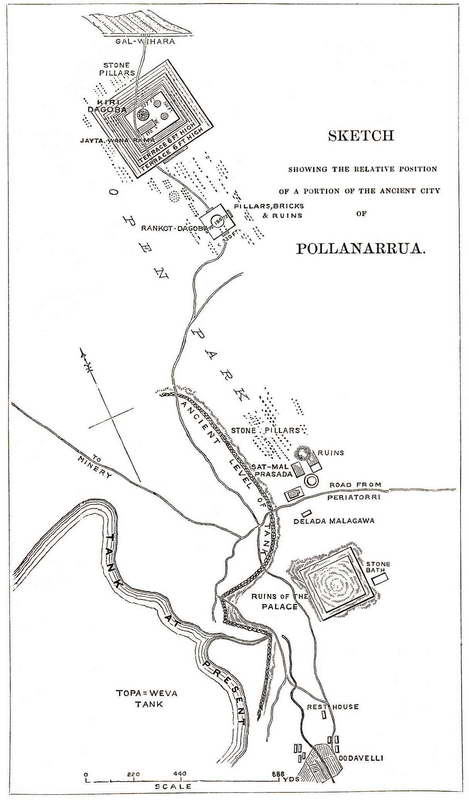
Sketch showing the relative position of a portion of the ancient city of Pollonaruwa. Publisher: Ceylon: an account of the island physical historical and topographical by Sir J.E. Tennent, 3rd edition (London: Longman, Date: 1859). « Back | ^ | Next » Share Post Pinterest reddit Messenger Whatsapp tumblr
Labels & Emblems Prints & Artwork Galle Face Hotel luggage label early 1900s Bawantha January 4, 2011 1 min read 0 Galle Face Hotel luggage label early 1900s #IMG756
Prints & Artwork VOC Antique map of Ceylon Bawantha July 29, 2008 1 min read 2 p.111 – Click on Image to View Full-size Photograph Antique map of Ceylon manuscript map by VOC
Prints & Artwork Fort of Galle from the Peninsular Bawantha July 28, 2010 1 min read 1 
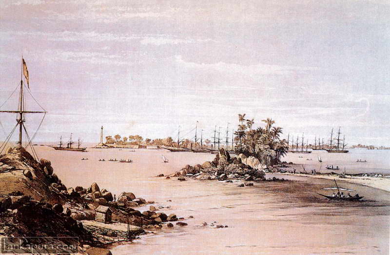
Fort of Galle from the Peninsular and oriental company’s station on closenberg island.
Prints & Artwork Botanical Print by Ernst Heyn of tropical epithytes of Ceylon 1895 Bawantha April 10, 2010 1 min read 0