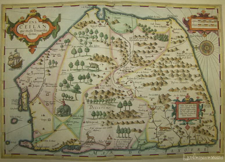
INS. CEILAN QUAE INCOLIS TENARISIN DICTUR. An early engraved map of the the country orientated with east at the top. Embellished with three decorative cartouches. Animals on the land area.
Map of the island Sri Lanka,. “Ceilan insula.”
Beautiful old-colouring, Latin edition, Amsterdam, 1623
[Published in: “Atlas sive Cosmographicae meditiones de Farbrica Mundi…”]
copper engraving
Cartographers
Gerard Mercator (1512-1594) was a Flemish cartographer. He was born in Rupelmonde in East Flanders in the Holy Roman Empire of the German Nation to parents from Gangelt in the Duchy of Jülich (modern Germany). Since 1552 he lived in Duisburg. He is remembered for the Mercator.
Jodocus Hondius (* 1563; † 1612) was a Flemish artist, engraver, and cartographer.
Description
This is a very beautiful, old-coloured and heightended in gold copper engraving map out of a Latin edition of the “Atlas sive Cosmographicae…” from Mercator-Hondius.
This interesting map shows the island Sri Lanka, former also Ceylon.