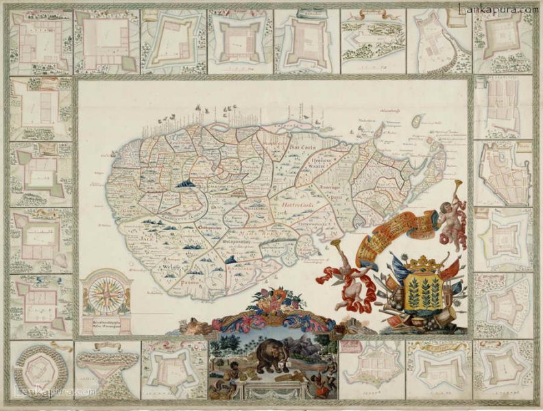
what a wonderful concept you guys have….i’m really proud of this activity. keep it up. and also i wanted these kind of ancient maps as im a student of faculty of architecture university of moratuwa, for my further studies of the dissertation im working on. please upload more ancient maps of Galle town as i’m studying about the evolution of the urban layers of galle town. thank you very much for prroviding these kind of educational material to the students.
 p.111 – Click on Image to View Full-size Photograph

what a wonderful concept you guys have….i’m really proud of this activity. keep it up. and also i wanted these kind of ancient maps as im a student of faculty of architecture university of moratuwa, for my further studies of the dissertation im working on. please upload more ancient maps of Galle town as i’m studying about the evolution of the urban layers of galle town. thank you very much for prroviding these kind of educational material to the students.
Kindy upload or send me the link to view maps which are having ancient buddhist related areas like hiriwadunna…Thanks.