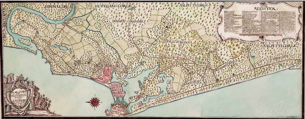
VOC Map of Colombo & surrounding area 1750-1800 VOC Map of Colombo and surrounding #IMG255 Title: VOC Map of Colombo & surrounding « Back | ^ | Next » Date: 1750-1800 Technique: coloured drawing Photography/Artist: Wohlfarth, C.C. (land surveyor / mapmaker) Locations: Colombo [Columbo, Calamba, Kolombo, Colombe] Share Post Pinterest reddit Messenger Whatsapp tumblr
Prints & Artwork Fresco Paintings at Sigiriya Rock, Seegiriya Sri Lanka Bawantha September 3, 2008 1 min read 0 THG Sigiri Frescies (Sigiri Lalanavo or Sigiri Apsaravo)
Prints & Artwork Government official visiting native village Bawantha July 4, 2008 1 min read 2 p.105 – Click on Image to View Full-size Photograph Illustration of a government official visiting native Sinhalese village
Prints & Artwork Luggage Label, Queen’s Hotel Kandy c.1927-30 Bawantha July 26, 2010 1 min read 0 Queen’S Hotel Kandy, Luggage Label, Ceylon C.1927-30 #IMG697
What do you mean by VOC? and to which time period this map belongs?