
Title: VOC Map of Colombo & surrounding
Date: 1750-1800
Technique: coloured drawing
Photography/Artist: Wohlfarth, C.C. (land surveyor / mapmaker)
Locations: Colombo [Columbo, Calamba, Kolombo, Colombe]
Historic Images of Sri Lanka
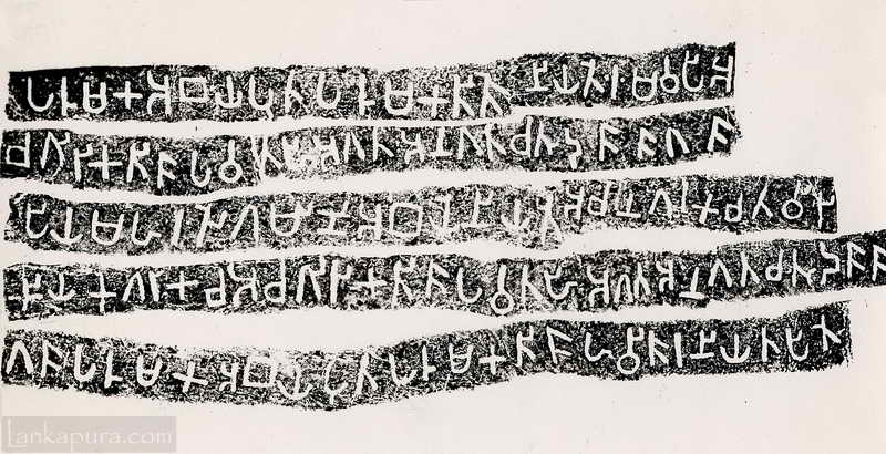
Thonigala Stone Inscription Sri Lanka #IMG701
p.105 – Click on Image to View Full-size Photograph Illustration of a government official visiting native Sinhalese village
Sigiri (Lion Rock) is a unique ancient fortified city with Moats, Ramparts and Gateways.
What do you mean by VOC? and to which time period this map belongs?